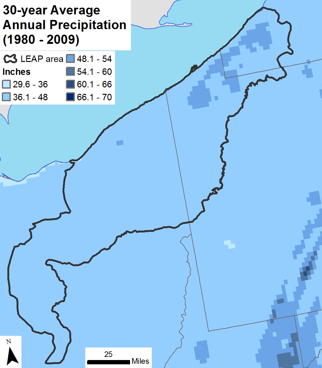
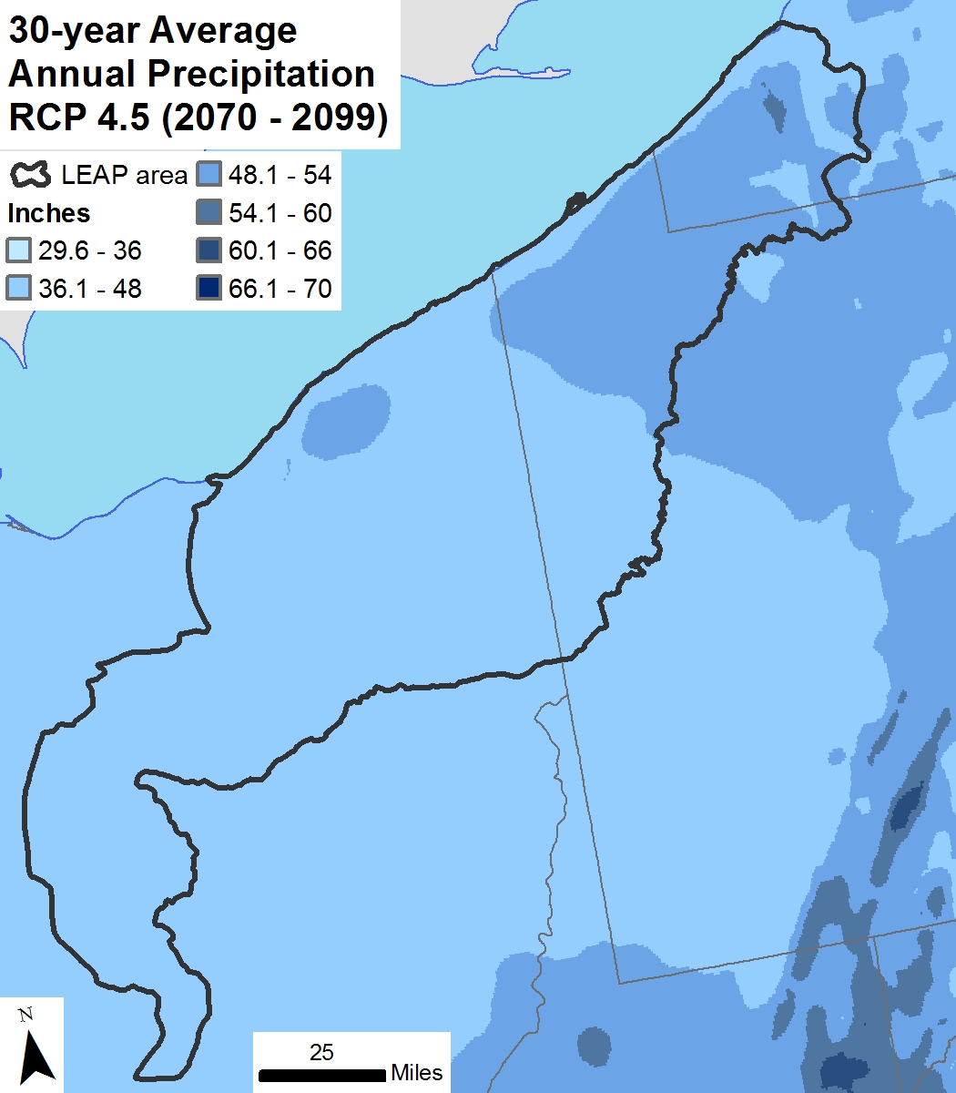
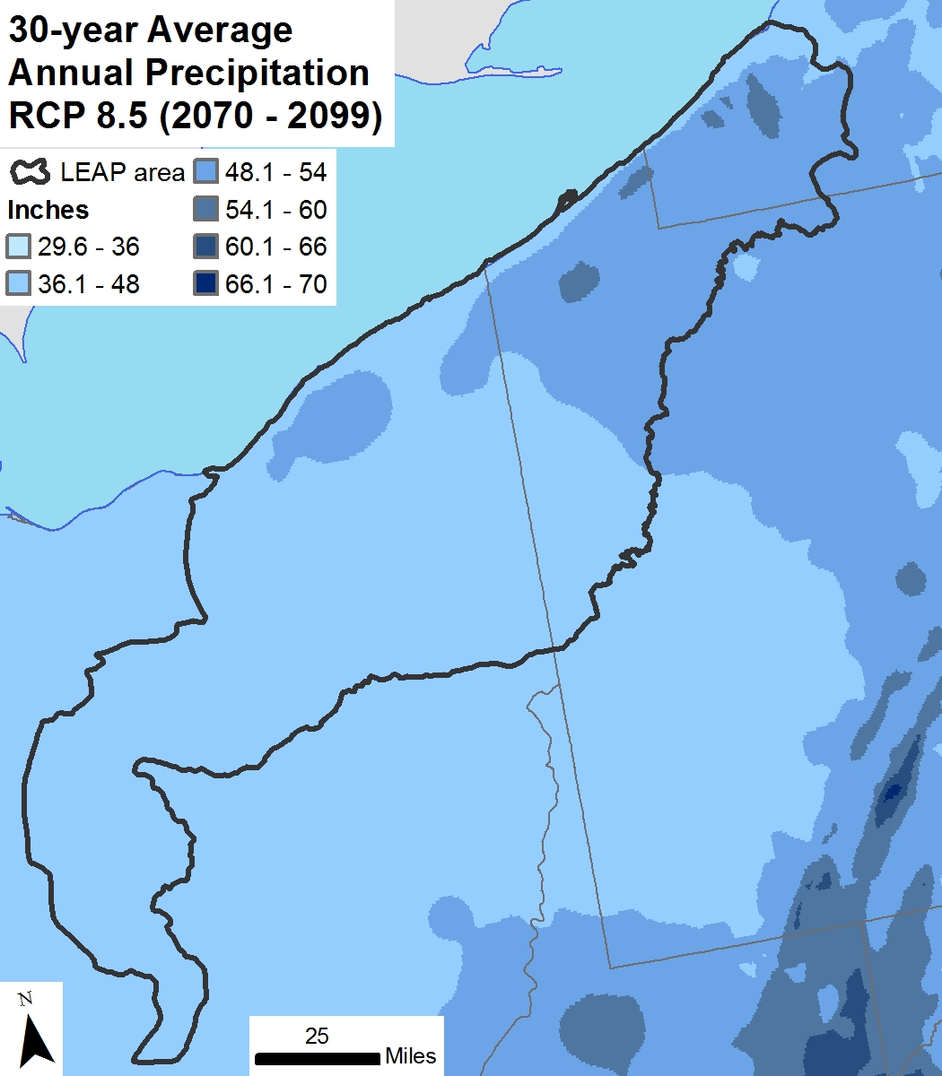
Annual precipitation change maps
LEAP region maps showing annual precipitation during a 1980-2009 baseline period and increases by the end of the century under scenarios of moderate greenhouse gas concentration (RCP 4.5) and high concentration (RCP 8.5).